


The geological heritages in the Mount Lushan Geopark and its surrounding areas are dominated by the eroded structural landforms, structural-denudated landforms, karst-eroded structural landforms, glacial landforms and flow water eroded and accumulated landforms.
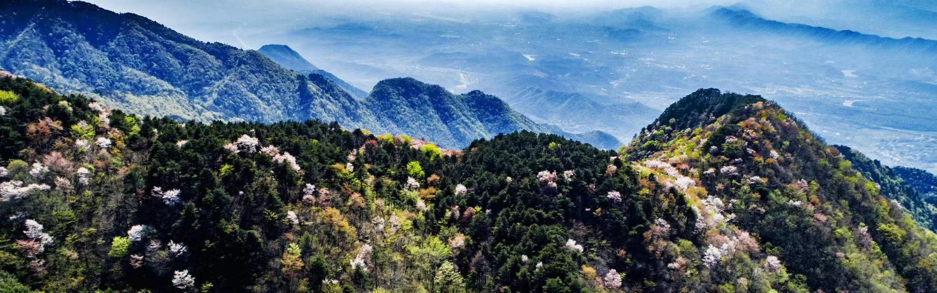
The geomorphic features in the geopark are the mountain-hilly area-mound-plain in descending order. Because the Lushan Mountain is a fault block mountain, the lower hills are absent. The glacial eroded landform is the most distinct one in the geopark, followed by the structural and flow water landforms.
1 Glacial eroded landforms
The Lushan Mountain is the most typical and abundant in Quaternary glacial landforms in the east of China.
1.1 Landform features
(1) Glacial eroded landforms
Cirque
The cirques in the Lushan Mountain area are as follows: Da,ao Cirque, Huanglong Cirque, Wurusi Cirque and Guzizhai Cirque.
The Da,ao Cirque is at the northwest side of Dayueshan Crest and south cliff of Wangjiapu U-shaped Valley. The cirque is about 300m long, 250m wide and 100m deep. The cirque floor is flat, slightly dipping toward the north, surrounded by peak cliffs, a cliff is present below the cirque outlet. The relic of cirque stairway is at the left side of the outlet, the stairway is 20-30m higher than the floor. The finding of post-glacial grayish black ooze in the cirque indicates it was a small lake. The cirque is composed of the Nanhuan pebble-bearing sandstone.
The Huanglong Cirque is near the Huanglong,an of the northeast of Yangtianping area. The cirque is about 300m long, 250m wide and 100m deep. The elevation of the cirque floor is about 1,250m, dipping toward the northeast. It looks like a conformable chair. The cirque is composed of the Nanhuan pebbly silicifized sandstone.
The Guzizhai Cirque is located between the northwest of Xianglufeng Peak and south of Wulonggang Ridge. The cirque is about 300m long, 200m wide and 70m deep. The elevation of the cirque floor is only 500m, dipping toward the southeast. The cirque is composed of the Late Proterozoic amphibolite leptite.
Firn-basins
The Quaternary firn-basin traces are well preserved, such as the Lulin firn-basin, Honglongsi firn-basin, Sanyixiang firn-basin, Yaowa firn-basin, all these holes are composed of the Nauhuan pebbly sandstone.
The Lulin Firn-basin is just the side of Lulin lake, just below the Daxiaochang U-shaped valley. The Hole is about 1,300m long, 750m wide, its bottom elevation is about 1,000m, slightly dipping toward the northwest. It was once a natural mountain lake before modified into an artificial lake. A glacial stairway trace is still present near the Lulin Bridge.
The Sanyixiang Firn-basin is just in the Lushan Botanical Garden. The Hole is about 720m long, 410m wide and 150m deep, its bottom elevation is about 1,000m. The outlet is slightly dipping toward the northeast. A glacial stairway trace is still present below the Wangpoting Pavilion.
Glacial U-shaped valleys
The well-preserved U-shaped valleys in the Mount Lushan Geopark are: Wangjiapo, Daxiaochang, Donggu, Xigu, Qilichong, Shimenjian and Changlongjian U-shaped valleys.
The Wangjiapo U-shaped valley is located between the Dayueshan Crest and Xiaotianchi- Dazhaishan Crest of the northeast of Lushan Mountain. The valley is up to 4,000m long, about 700m wide, the elevation of valley bottom source is about 200m. It is U-shaped in a cross section, and stepwise in a longitude section, the upper is narrower, and lower wider. There are small U-shaped valleys in the valley. A terminal moraine is present at the valley bottom, with moraine deposit. A typical glacial streak boulder has been found in the valley. This boulder is over 5m in diameter, pentagonal, composed of hard and dense quartzose sandstone, there are five streaks on the boulder, about 5-19cm long, 0.7-1.5cm wide and 0.5-3cm deep, the general direction of these streaks is same to the valley,s long axial direction.
The Daxiaochang U-shaped valley is located between the Nuercheng Crest and Changgeng Crest. The elevation of the valley bottom source is about 1,350m, that of the valley mouth is about 1,100m. It is up to 3,000m long, about 170m wide, the residual depth is only 30-50m. The end of this valley is connected with the Lulin Firn-basin. The moraine deposit is present at the valley bottom, with glacial squeezing and grinding rock powder. In 1986, the Secretariat of the International Quaternary System Association visited this valley and found some bomb- and iron-shaped boulders and streak boulders, he considered that these boulders are identical to these in Alps region.
The Shimenjian U-shaped valley is located below the Huanglongsi Firn-basin. Although this valley was seriously damaged by the flowing water, the basic features of a U-shaped valley are still clear. The elevation of the valley bottom is about 800-400m. This valley is about 1,200m long. It is stepwise in a longitude section, a series of glacial stairways and basins are arranged in order. There is a glacial stairway at the Shimenjian Waterfall, with a glacial basin below. The famous Shimenjian Stairway is about 320m long, 80m wide, there is a saddle-shaped notch at the middle of the stairway, it might be a wind outlet of the stairway.
Hanging valleys
Some glacial hanging valleys are well preserved in the Mount Lushan Geopark, they are: Liangu, Lulin, Hankouxia and Yuelunfeng hanging valleys.
The Liangu Hanging Valley is situated on the great Wangjiapo U-shaped Valley. It is a small glacial U-shaped valley, between the Wujiling and Rizhaofeng Crests. The elevation of the hanging valley bottom is about 100m higher than that of the Wangjiapo Valley. There are no faults at the steep sides of the glacial staircases.
Hankouxia Hanging Valley is at the southwest end of the Donggu U-shaped Valley. This small valley is derived from a glacial spillway at the side of the Daxiaochang U-shaped Valley, highly hanging above the Donggu U-shaped Valley about 50-70m. There are no faults at the steep sides of the glacial staircases.
Glacial spillways
The relics of glacial spillways in the Lushan Mountain area are distributed in the north of Xianrendong Cave, northwest side of the Xigu U-shaped Valley, Tianqiao, Nuerchang Crest.
Glacial chutes
The glacial chutes are mostly distributed in the two sides of glacial U-shaped valley and source areas, such as in Dazhiainou, Mumachang, east slope of the Dayueshan Hill and Dumiwa areas. The chute elevation o is generally above 1,000m.
Glacial slopes
There are many glacial slope traces in the Lushan Mountain, among them, the Jinzhu Glacial Slope is relatively well preserved. This slope is located at the north slope of the Huanglong Cirque, the elevation of this slope is between 1,300m and 1,000m. The slope is, composed of the Nanhuan pebbly sandstone, about 1,000m long, 500m wide, with a slope angle 20° ~25°. There is an inactive moraine deposit of clay boulders on the slope.
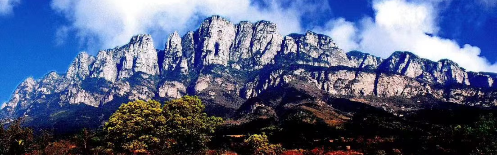
Crests
The crests in the Lushan Mountain are mostly precipitous, they just like sharp swords high to the sky, the rocking stones seems easy to fall down. The elevation of these crests is between 1,150m and 1,470m, forming a very important part of the magnificent view of the Lushan Mountain. The major crests are: Dayushan, Wujiling-Nuercheng, Xiaotianchi-Dazhaishan (Houziling), Gu,niuling, Jiuqifeng, Hanpoling, Suozigang, Xianrenji, Hongshiya and Wulaofeng Crests. These crests are mainly composed of the Nanhuan sandy conglomerate and Qingbaikouan acid lavas.
The Hanpoling Crest is most distinct. It is extremely steep, its extending direction is not identical to the rock strike, nor to the joint or cleavage orientation. The crest extending direction is 260°-80°, the rock strike is 230°-50°, and that of axial shearing plane is 220°-40°. There are four sets of structural joints in sandstone, neither direction is same to the crest direction. There are no faults along the crest extending direction. So the crest should be resulted from the glacial effect.
Glacial horns
The glacial horns in the Lushan Mountain, such as the Taiyifeng Peak, Litoujian Hill and Rizhaofeng Peak, are pyramid-like, about 1,300m above the sea level, the height difference is over 100m. These horns are composed of pebbly sandstone.
(2) Glacial motion vestiges
Glacial pavements
The glacial pavement traces are founded in the Taiyicun, Mumachang and Chemical Fibre Factory areas. There are some unclear glacial streaks on the sandstone walls near the Mumachang area. Professor Li Siguang once discovered a glacial pavement trace near the site of Chemical Fibre Factory, unfortunately, this trace was eliminated by the port construction. A smooth basement rock (limestone) surface of an area of about 4m2 with clear and dense parallel glacial streaks was revealed and discovered near the Chemical Fibre Factory in 1983. This basement rock is covered by the Dagu-phase glacial moraine muddy boulder bed. The streaks extend in NE-SW direction, which is just identical to the glacial movement.
Epigenetic structures
The Xiaqingshan Epigenetic Structure: the basement rock of the Dagu-phase moraine muddy boulder bed is the Silurian sandy shale, the surface of basement rocks is of some crumples and small-scale thrusts, the basement rocks back to normal 5m below the epigenetic structure. The direction of the folded axial plane is same to the thrust orientation, which is identical to the glacial moving direction, that is, from the southwest to northeast.
The Dapailing Epigenetic Structure: There is a huge boulder ploughing into the surface of Lower Proterozoic quartz-mica schist beneath the Dapailing-phase moraine muddy boulder bed. Some drag folds are occurred, some basement lumps are involved into the bottom of the tillite.
Shetouling Epigenetic Structure: There are typical epigenetic structures on the Cambrian shale surface beneath the Dagu-phase moraine muddy boulder bed. The ductile deformation is clear on the shale surface (1m deep), the deformed direction is just insistent to the glacial moving direction, that is, from the southwest to northwest.
Drift boulders
There are many huge drift boulders in the geopark. These boulders came from the rocks on the top of Lushan Mountain. The transportation distance is up to 10-12km. The boulders with a maximum about 7.2m in diameter are found on the tops of Jindingshan Hill (193m) and Dapailing Ridge (284m). The boulders are unsorted, extending into the beach area of Poyang Lake. In the Jiudiegu Valley and Xigu U-shaped Valley, there are glacial tables composed of accumulation of huge boulders.
Oblique structure
There are oblique structures in the Middle Pleistocene Dagu-phase moraine muddy boulder bed in the beach area of Gushanhu Lake, west of Xiaqiangshan Hill. The boulders are obliquely arranged with the maximum boulder over 1.2m in diameter. The dipping angle becomes gentle from the east to west (from 80° to 35°). The a-axis of boulders is along the oblique layer, the ab surface is roughly identical to the orientation of the oblique layer. The oblique layer is also found in the Dapailing-phase moraine muddy boulder bed.
Nose-hill end and sheepback rock
Xieshan Nose-hill end: The Xieshan Hill at the center of Poyang Lake is composed of Upper Paleozoic carbonates. The isolated hill is high and wide in southwest, lower and narrow in northeast, the long axis is in NE-SW direction, about 370m long, 110m wide. The hill, with a height of 90.3m, is steep in east, and gentle in west, the whole hill is just like a nose. The drift boulders from the Lushan Mountain were once found at the locality about 30m above the lake level. Professor Li Siguang considered that the Xieshan Hill was shaped by the glacial abrasion on the both sides, he called this specific glacial landform as the Nose-hill end.
Sheepback rock
There were once many sheepback rocks on the beach area of Poyang Lake. The rocks are composed of the Carboniferous limestone, these rocks were resulted from the glacial abrasion when the glaciers moved toward onto the different basement rocks. There are abrasion traces clearly on these rocks.
(3) Glacial moraine landforms
Terminal moraine
The snaking terminal moraines are distributed in the Daling, Changling, Xiaqingshan and Baishizui areas at the east slope of Lushan Mountain and Xinqiao, Shetouling (Yangjiaoling), Donglinsi and Saiyang areas at the west slope of Lushan Mountain. The best preserved moraines are along the belt from Gaolong to Baishizui. These moraine hills are generally about 20m high or lower, bending toward the northeast. There are four parallel moraine hills in this area, there are the outwash sand-gravel beds in the areas between each two moraine hills.
Flank moraine
The most typical flank moraines are the two flank moraine muddy boulder hills about 10m high at south and north sides near the Wangjiapo U-shaped Valley outlet.
Outwash terrace
The alluvial terrace composed of sand-gravel beds, sand, mid clays is widely spread in areas front of the terminal moraine hills, these alluvial outwash sediments are usually transitional to the moraine beds. These outwash terraces are widely distributed on the mountain slope area. The most typical outwash terraces are distributed along the Xizixian city to Yejialong belt and Shilipo to Balihu Lake belt. These terraces are 60-80m high, the terraces dip to lake area. The terrace is about 1-3km long and 500-800m wide.
1.2 Glacial eroded landform patterns
In general, the Lushan Mountain body is not too big, belonging to an isolated fault block mountain. The snow cover area is small and the melting area wide. The U-shaped valleys and crests are developed. The moraine muddy boulder beds are widely covered on the piedmont plains and depressed areas. In addition, the Lushan Mountain is a middle mountain at the middle altitude area. The warm and cold spores and pollens are mixed in moraines. It has proved that the Quaternary glaciers and their eroded landforms in Lushan Mountain area belong to the maritime ice-foot glacier.
1.3 Development conditions and forming process of the glacial landforms
(1) Development conditions
Climate condition
The climate condition is very important in forming the ice-foot glacier. It needs a large snowfall, higher negative temperature, lower snowline, and the temperature of glacial constant temperature layer approaching to zero or melting point. The glacier would be active, the glacial tongue could extend to lower forest area. The glacial geological-geomorphic action would be strong and clear. It has been proved by the recent scientific achievements that the Qinghai-Tibet Plateau was only about 1,000~1,200m high in the early Pleistocene. The Lushan Mountain in the east of China was belonging to the maritime climate. During the Quaternary glacial period, the sufficient snowfall was available.
Topographic condition
The Lushan Mountain is an isolated block mountain, highly standing on the wide plain. The vertical air convection was strong, and the rainfall was heavy. In addition, the Lushan Mountain was steep in four sides but flat on hill tops, the heavy snowfall could be accumulated to form glaciers.
Structural condition
The south part of the Lushan Mountain is composed of the Pre-Sinian epimetamorphic and volcanic rocks, the rock orientation is relatively steep, schistosity developed. There are two sets of X-shaped shearing joints in rocks. The rocks are deficient in porous water, and the spherical weathering could not be formed only with densely enclosed shearing joints. It could not provide sufficient rock pieces to glaciers, so the glacial erosion was weaker, the terminal moraines are lack of glacial sediments, and the glacial eroded landforms are undeveloped.
The north part of the Lushan Mountain is composed of the Nanhuan sandy conglomerates. The rock orientation is gentle. The shearing joints are developed, there are abundant porous and fissure water in rocks, the spherical weathering was strongly developed during the ice age. There are sufficient boulders, pebbles in the glaciers while they moving on. The glacial erosion was strong, and various glacial eroded landforms were formed. The terminal moraines are full of glacial sediments.
(2) Forming process of the glacial landforms
The accumulated snows above the snowline would be changed into firns through the thaw consolidation. When the firn layer would be over 40m thick, under the thermal and pressure effect, the firn recrystallization would make the firns into firn ices. The air in firns would be discharged under pressure, the light blue glacial crystals might be formed. The firn basins might be changed into glacial cirques during the forming process of glacial ices. When the ices are accumulated in cirques to certain extend, the glacial ices could overpass the stairways and become the moving glacial tongues, so the small-scale glaciers would be formed. As the ices accumulated, the glacial tongues would flow downward to the valleys under gravity, so the valley glaciers and U-shaped valleys might be occurred. The cirque and valley glaciers should form the firn basins under suitable conditions, the more glacial ices might be accumulated.
When the glaciers reached to the piedmont plains via the U-shaped valleys, the ice fans might be formed, covering on the piedmont plains and depressed areas. At that time, the ice-foot glaciers would be formed.
1.4 Subdvision for Quaternary glaciers in Lushan Mountain
In recent three decades, the international advances on the Quaternary glacial and interglacial classification have been achieved through the paleo-magnetism, chronostratigraphy and isotope dating studies. C. Emiliani, J. Shackleton and N. Apdyke studied the deep sea sediments over past 0.9ma, they used the isotopic stratigraphy to divide these sediments into 22 stages including 11 warm-cold cycles. This result provides evidence for the Quaternary glacial and interglacial classification and correlation. Base on the Quaternary stratigraphic study in the Lushan Mountain area, the Chinese scientists made a detailed classification for the Quaternary glacial and interglacial stages with the use of 9 methods. This classification is based on the study of Quaternary sedimentary sequences, together with the geomorphic differences of moraine and outwash sediment areas, moraine and outwash sediment sequences, color and weathered degree of the moraine and outwash beds, mineral combination in moraines, geochemical properties of moraine and outwash beds, mcirostructural features of moraines, biological remains in moraines, as well as paleo-magnetic stratigraphic study.
According to this classification, the Quaternary could be divided into the followings (in ascending order): the Dapailing glacial phase (3-2.5ma ago), Dapailing-Poyang interglacial phase, Poyang glacial phase (1.8-1.5ma ago), Poyang-Dagu interglacial phase, Dagu glacial phase (1.1-0.9ma ago), Dagu-Lushan interglacial phase and Lushan glacial phase (0.4-0.2ma ago). The Dapailing and Poyang glacial phases belong to the Early Pleistocene, the Dagu glacial phase to the Middle Pleistocene and the Lushan glacial phase to the Late Pleistocene.
1.5 Advances in Quaternary glacial study in Lushan Mountain
Li Siguang firstly discovered the Quaternary glacial vestiges in the Lushan Mountain in 1931. Based on his systematic and detailed study, he published a paper entitled “Quaternary glaciations in the reaches of Yangtze River”in 1933 and another paper “On glacial evidence from the lower reach of Yangtze River”in 1934. He deeply believed that there were multi-phase glaciations in the Lushan Mountain during the Quaternary period.
As estimated by Li Siguang, the discovery of Quaternary glaciers in the Lushan Mountain was doubted and criticized. Some foreign scientists who worked in China, such as G. B. Barbour (Britain), E. Nystrom (France), T. Dechardin (Germany) and E. Norin (Sweden), were skeptical. They considered that the Lushan Mountain is situated a relatively lower altitude area, and the mountain is not a high one. In 1934, a famous field meeting was held in the Lushan Mountain attended by Li Siguang, T. Dechardin, G. B. Barbour, E. Norin and C. C. Young, they did not reach a same conclusion. G. B. Barbour and T. Dechardin also published some papers in which they considered that there were no any glaciations in the east of China during the Quaternary period.
During his lecturing period from 1934 to 1936 in Britain, Li Siguang further explained his thought that the Quaternary glaciations did exist in the Lushan Mountain. He investigated the British Quaternary glaciations with L. J. Wills, and the glaciers in Alps with Li Chunyi and Wang Hengsheng, he collected many first-hand data, he firmly believed that the glaciers in Lushan Mountain belongs to the Alps type. After he came back in 1936, Li Siguang published a book entitled “Glacial Phase in Lushan Mountain”in 1937. In this book, he systematically described the Quaternary glacial vestiges in Lushan Mountain, dividing the Quaternary into three glacial phases and two interglacial phases, comparing with the Alps glaciers. This book founds a firm basis for Quaternary glacial geology in China.
Since 1940s, many famous geologists in China have published their papers on the Quaternary glaciations in Lushan Mountain, most of them agreed with the Li,s idea. In the late of 1950s, Nariferkin, a Russian Academician, came China to take a geological meeting, accompanied by Li Siguang, he visited the Lushan Mountain, and changed his belief that there were no Quaternary glaciations in the east of China. He became a firm supporter to Li,s idea. He issued a paper “A glorious page in Asian geological history” to introduce the Quaternary glaciations in the Lushan Mountain.
In the early of 1960s, Huang Peihua proposed in his paper that there were no climate conditions for forming glaciers in the Lushan Mountain during the Pleistocene, this paper was rejected by other scientists (Z. Cao and X. Wu). At the same time, S. Kozaski, a Polish scientist visited the Lushan Mountain and found a terminal moraine trace in Xinqiao section, he concluded that the Quaternary glaciations did exist during the Pleistocene in China. The Dapailing glacial phase moraine was discovered in 1960s during the work of regional geological mapping. In 1978, a national Quaternary geology meeting was held in the Lushan Mountain, many scientists believed that the Lushan Mountain is the birthplace of Quaternary glacial geology in China. C. C. Young, who took part in the debate in Lushan Mountain in 1934, changed his idea and turned to support the Li,s idea on the meeting.
In 1980s, Shi Yafeng and several geographers published a series of papers and books to reject the Li,s idea. They believed that there were no Quaternary glaciations in the lower and middle mountain in the east of China.
From then on, many scientists from different institutions and universities have kept coming to study the geology in the Lushan Mountain. The more evidence for Quaternary glacial vestiges in the Lushan Mountain has been discovered. The geologists from the Tianjin Institute of Geology and Mineral Resources found the Dagu-phase white muddy boulder bed in Xiaqingshan area, it gave a positive support to the existence of Quaternary glaciations in the Lushan Mountain.
During 1980s, many foreign scientists from the United States, Czech, Britain, Sweden and Canada came to the Lushan Mountain for their investigations. Some of them found the glacial vestiges. The climate study has proved that the snowline at the Lushan Mountain area during the glacial phases might be 1,225m above the sea level.
A high altitude and plateau cold-type small-mammal fauna has been found in the Hexian county, east of Lushan Mountain, it has proved that this fauna was occurred during the Dagu-phase glacial phase. This discovery indicates that the cold glacial climate did take place in the lower reach of Yangtze River during the Quaternary period.
The book“Quaternary Glaciations and Environmental Problems in east China”(Shi Yafeng, et al., 1989) concluded the rejecting ideas and evidence for the Quaternary glaciations in the east of China.
In 1990s, He Peiyuan and others made a detailed study on the Quaternary glacial geology in the Lushan Mountain, this study provided much information for the Quaternary glaciations and climate and environmental changes.
To sum up, the debate for whether the Quaternary glaciations present or absent in the Lushan Mountain has been lasted for over 70 years, and the debate is going on. More and more data show that the Quaternary glaciations did happen in the Lushan Mountain. We believe that the more we study, the more we understand about the Lushan Mountain.
1.6 International correlation of Quaternary glaciers
At the end of the Neogene, the global climate turned to be cold, the ice sheets and mountain glaciers were widely spread in two pole areas, high altitude area, plateaus and high mountains in middle and lower altitude areas, it is called as the Quaternary or Late Cenozoic great glaciation. At the beginning, the huge ice body was formed in the Antarctic area, the ice sheets in Iceland and Greenland might start about 2.3ma ago. The Quaternary glaciations influenced in Europe, the South and North Americas. The mountain-type glaciers were occurred in Asia. The glaciers in Lushan Mountain were the mountain-type ice-foot glaciers during the Middle to Late Pleistocene.
The Quaternary glaciers in the Lushan Mountain could be correlated with the same time glaciers in Europe and America.
(1) Poyang Glacial Phase: It was named by Li Siguang, representing the oldest glacial phase in the east of China. It is dominated by purple hard and closely-cemented muddy boulder bed, with a deeper humid-heat extend. There are many white muddy bands, about 1cm wide, displaying many honeycomb-like pores after weathing. The outwash sediments and drift boulders near Jiujiang city. It was a large-scale ice-foot glaciation. In the north of Alps, the moraines of this phase are represented by the weathered and older boulder beds, banded distribution. It is called as the Günz glacial phase. It is roughly corresponding to the Menapian glacial phase in the north Europe and the Nebraskan glacial phase in the North America. This glaciation was taken place about 1.5-1.3ma ago, the ice sheets were widely distributed.
(2) Dagu Glacial Phase: It was named by Li Siguang. The typical locality is at the Dagushan Hill by the Poyang Lake. It is dominated by the red muddy bounder bed, the diagenetic grade and humid-heat extend are lower than these in Poyang phase. The broader white muddy bands are common, reticulated, widely distributed. The U-shaped valleys, sheepback rocks, glacial pavements and epigenetic structures are occurred, with many parallel terminal moraines. It could be subdivided into two subphases.
It is roughly equal to the Mindel glacial phase in Alps, named by A. Penck in 1901. The Mindel phase in Alps could subdivided into 2-4 glacial subphases. It could be correlated with the Elster glacial phase in the North Europe and the Kansan glacial phase in the North America. It took place about 0.4-0.32ma ago.
(3) Lushan Glacial Phase: It is composed of yellowish brown moraine muddy boulder bed interbedded with outwash deposit, representing a small-scale valley glacier and cirque glacier. It is limitedly distributed on the hill top areas, indicating the last glacial phase in the Lushan Mountain area.
In 1882, A. Penck named the Riss glacial phase in Rhine River Valley and Riss River Valley of the north of Alps, it is the fifth glacial phase of Late Pleistocene in Europe, it occurred about 0.21-0.12ma ago. This phase is roughly equal to the Saale glacial phase in the North Europe and the Illinoian glacial phase in the North America. The Lushan glacial phase could be correlated with these above.
(4) Dali Glacial Phase: It was named by H. V. Wissmann based on a suite of glacial eroded landforms and moraines in the area about 3,800m high of Dianchangshan Mountain, Dali, Yunnan, China. Li Siguang pointed that this phase is the end glacial phase in China, it is later than the Lushan phase. The glacial vestiges of this glacial phase are also found in Taibaishan and Changbaishan Mountains of China. In the Lushan Mountain area, it is called as the Lulin ice-marginal phase.
The Würm glacial phase is the end glaciation in the north Alps, named by A. Penck in 1882. The glacial sand-gravel beds formed the lower terraces of river valleys. It could be correlated with the Weichselion glacial phase in North Europe and the Wisconsin glacial phase in North America, about 80,000 to 11,000 years ago. This phase could be subdivided in three glacial subphases.
Through the international correlation, the Quaternary glacial eroded landforms in the Lushan Mountain area are very distinct, representing the typical maritime ice-foot glaciation of the middle mountain in the middle altitude area.
2 Structural landforms
2.1 Structural landform patterns and features
(1) Fault block mountain landforms
There are 2-3 high-angle (75°-80°) normal faults in the west of Lushan Mountain, they are the western boundary of the Lushan Mountain. The fault planes are straight cliffs, locally with terminal facets, without transitional belt with the piedmont plain. The fault cliff is commonly a silicified zone, the rocks are hard, forming a series of peculiar peaks and precipitous stones, it displays a view of marvelous structural landforms.
The east side of the Lushan Mountain is defined by the vertical shearing planes, forming the steep cliff on the mountain boundary.
(2) Narrow valleys and cliff structural landforms
The most of narrow valleys in Lushan Mountain are located in the halfway and slope areas, distributed along the vertical shearing joints, both sides of cliffs are smooth and straight. The elevation is between 800m and 400m, about 1-2km long, the dipping angle of a valley bottom is about 18°. They are: Jiudiegu, Shimenjian, Liujiazhai, Wulonggang, Shijingxi, Jinxiugu and Pan,g anyuan Valleys.
There are two sets of X-shaped shearing joints (nearly vertical) in the hard rocks in the geopark, during the crust uplifting period after glaciations, the flowing water made a strong erosion, the rocks would be unstable, and collapse down along the shearing joint planes. This process produces a lot of smoothly vertical cliffs, especially developed in valley areas. The unique cliff landforms composed of clusters of grand and peculiar vertical cliffs are occurred in the Lushan Mountain. For instance, the Jiudieping Cliff, just at the north of Sandiequan Spring, the vertical cliff is 260m high and 700m long, the view is just fantastic. Other examples are the Shimenjian, Tianchishan, Zhaojiangya, Longshouya, Shizikou, Houziya, Maguya, Wulaofeng, Muguaya, Lingxiaoya, Huangyueya, Xingheya, Huilongya, Qiaotingshan, Xiangludun and Huangyan Cliffs.
(3) Peculiar peak and precipitous stone structural landforms
There are 77 peculiar peaks named by ancient people. These peculiar peaks and precipitous stones constitute a marvelous picture which is of great value for tourism.
The Wurufeng, Xiaoshuangjianfeng and Xianglufeng Peaks are composed of hard Early Proterozoic leptite; the Huanglongshan, Tianjingshi, Maerfeng, Shierfeng and Xiaowulaofeng Peaks (or Stones) comprise the Meso-Proterozoic epimetamorphic rocks; the Hanyangfeng, Jinlunfeng, Qiaotingshan, Xi,n iufeng, Zixiafeng, Shuangjianfeng, Banrufeng, Nankangjian, Taohuafeng and Dabujian Peaks consist of Late Proterozoic acid volcanic rocks; and the Wulaofeng, Wuxiaofeng, Shangxiaofeng, Tiechuanfeng, Dapengfeng, Qiaofofeng, North Xianglufeng, Lianhuafeng, Yajishan and Dalinfeng Peaks are composed of Nanhuan sandstone.
The most of glacial crests and fault cliffs in Lushan Mountain have been modified into sawback and flame-like precipitous stones, they are really marvelous and charming. These stones are: Jiuqifeng, Suozigang, Wujiling, Shipaishi, Hongshiya, Xianrenji and Huangshiya Peaks. These precipitous stones stand closely like a forest composed of lifelike and jagged rocks of grotesque shapes. The Lion-head Stone, Ape Stone and Stone-drum Boat Stone on the Xianrenji and Yuanrenling Peak are composed of volcanic rocks; the Monkey Stone on Xiaotianchi Peak, the Mankind-head Stone on Foshouyan Peak, the Lion and Tiger Stones on Niaoershan Peak and the Monkey-head Stone on Wulaofeng Peak and many others are composed of the Nanhuan sandstone. These peculiar peaks and precipitous stones constitute an attracting view for tourists. These are belonging to the structural landforms.
Quaternary Glacial Phase Correlation in Major Areas Around the World
| Age
Regions
|
China
|
North Slope of Alps
|
North Germany
|
North America
|
| Late Pleistocene
0.4-0.01ma
|
Dali
glacial phase
Lushan glacial phase
|
Wurm glaciation
Riss-Wurm interglacial
Riss glacial
|
Weichselion
(Eemian)
Saale glacial
|
(Wisconsin glacial phase)
Cochrane
Valders
Mankato
Cary
Lowan
(Sangamon interglacial phase)
Illinoian glacial phase
|
| Mid Pleistocene
1.1-0.4ma
|
Dagu glacial phase
|
Mindel-Riss interglacial
Mindel glaciation
|
(Holsteinian interglacial)
Elster glacial phase
|
(Yarmouth interglacial)
Kansan glacial
|
| Early Pleistocene
3-1.10ma
|
Poyang glacial
|
Gunz-Mindel interglacial
Gunz glacial
Denou-Gunzinterglacial
|
(Cromerian)
Menapian glacial
(Oling)(Waal) interglacial
|
(Aftonian interglacial)
Nebraskan glacial
|
| Dapailing glacial
|
Denou glaciation
Biber-Denou interglacial
Biber glacial
|
Eeblon glacial
(Tiglian interglacial)
Practiglian glacial
|
|
Selected papers and monographs of Quaternary glaciations in the Lushan Mountain
| 1933, Li Siguang, Quaternary glaciations in the reaches of Yangtze River. Bull. Geol. Soc. of China,
No. 13(1)
1933, Li Siguang, Geology of Lushan Mountain. Lushan Mountain Record
1934, Li Siguang, On glaciation problems in the lower reach of Yangtze River. Bull. Geol. Soc. of
China, No. 15(3)
1934, Barbour, G. B., Physiographic stage of Central China. Bull. Geol. Soc. of China, No. 13
1934, Barbour, G. B., Analysis of Lushan glaciation problem. Bull. Geol. Soc. of China, No. 13
1935, Dechardin, T. and Young, C. C., Cenozoic sequence in Yangtze valley. Bull. Geol. Soc. of
China, No. 14
1942, Li Siguang, Discussion on glaciations in China. Academic Collection, No.1 (1)
1947, Li Siguang, Glaciations of Lushan Mountain. Special monograph of Central Geological Institute.
1950, Sun Dianqing, et al., Distribution of Quaternary glaciers in south China and moraine
classification. Geological Review, 15(1-3)
1953, Ren Mei,e, Primary study on topography of Lushan Mountain. Acta Geographica, 19(1)
1957, Sun Dianqing, Summary of Quaternary glaciations of China. Science Press, Beijing
1957, Huang Ruicai, et al., Soil characteristics in Lushan Mountain area. Soil Bulletin, 5(2)
1958, Jing Cairui, Discussion on glacial eroded landforms in Lushan Mountain. Geological Review,
18(3)
1960, Sun Dianqing, et al., Glacial vestiges during the great glacial phase in China. Acta Geologica
Sinica, 41(3-4)
1962, Fan Tingxing, et al., Investigation on the Quaternary glaciations in the Lushan Mountain-
Poyang Lake. Regional Geology of Jiangxi, 2
1963, Huang Peihua, On glacial vestiges to the south of Yangtze River. Chinese Science Bulletin, 11
1963, Cao Zhaoheng, et al., About the glacial and interglacial phases in China. Chinese Science
Bulletin, 3
1964, Jing Cairui, Discussion on moraines in Lushan Mountain. A Paper Collection of Quaternary
Research Commission
1964, Cao Zhaoheng, et al., Glacial vestiges on the Lushan Mountain and its east slope. Chinese
Science Bulletin, 1
1964, Cao Zhaoheng, et al., Glacial landforms in the Lushan Mountain. Chinese Science Bulletin,
1
1964, Kozarski, S, Pleistocene glaciations in the mountains of east China. Geographic Translation
Bulletin, 1
1973, Li Yongzhao, et al, Discussion on Quaternary glaciations of China. Acta Geologica Sinica, 1
1975, Li Siguang, Quaternary Glaciations of China. Science Press, Beijing
1977, Sun Dianqing, Quaternary glacial phases of China. Acta Geologica Sinica, 2
1979, Zhou Tingrui, Discussion on Quaternary glaciations in east China. The 34th International
Congress on Geographpy, Tokyo, Japan
1979, Jing Cairui, On Quaternary glacial traces in Lushan Mountain. J. of Huazhong Normal
College, 1
1979, Sun Dianqing, et al., Research and advances on Quaternary glacial geology in China.
Developing Geological Sciences.
1980, Yang Huirun, et al., Evolution of Quaternary natural environment in east China. J. of
Nanjing University (natural science), 1
1980, Jing Cairui, et al., New discovery of epigenetic structures of Quaternary glaciations on the
northwest slope of Lushan Mountain. Chinese Science Bulletin, 25(9)
1981, Yao Tandong, Discussion on Quaternary glaciation problem by accumulated area ratio
method. Glacier and Frozen Earth, 3(4)
1981, Shi Yafeng, Are there Quaternary glaciations in Lushan Mountain? Newsletter of Dialectics
of Nature, 3(4)
1981, Zhang Linyuan, et al., Genetic discussion on the epigenetic structure in Yangjiaoling,
Lushan Mountain. Chinese Science Bulletin, 16
1981, Zhang Linyuan, et al., Characteristics and genetics of mixed depositions in Lushan Mountain.
Quaternary Research of China, 6(2)
1981, Xie Youyu, et al., Primary discussion on Quaternary sedimentary environment in Jiujiang-
Lushan Mountain area. Geographic Collection, No.13
1981, Li Jijun, et al., About Quaternary environmental evolution and geomorphic development in
Lushan Mountain. Science in China, B, 8
1981, Zhao Liangzheng, Glacial distribution role of Poyang glacial phase in Jiujiang-Lushan area.
In“Quaternary glacial sedimentation and geomorphology of China”
1981, Jing Cairun, On the debates in Quaternary glacial research of Lushan Mountain. In“Quaternary
glacial sedimentation and geomorphology of China”
1981, Derbyshire, E. D., Lushan Mountain: proving for glacial hypothesis. In“Quaternary glacial
sedimentation and geomorphology of China”
1982, Run Mei,e, et al., Some points on Quaternary glaciations of Lushan Mountain. Newsletter of
Dialectics of Nature, 4(2)
1982, Huang Peihua, Doubted on“Glaciations of Lushan Mountain”, Newsletter of Dialectics of
Nature, 4(2)
1982, Shi Yafeng, Evidence for Quaternary debris flows on the slope of Lushan Mountain. Chinese
Science Bulletin, 20
1982a, Zhou Mulin, Are there really Quaternary debris flows in Lushan Mountain? Newsletter of
Dialectics of Nature, 4(2)
1982b, Zhou Mulin, Debates on Quaternary glaciations in east China. J. of Huadong Normal College, 4
1982, Ting Menglin, Quaternary geology in Lushan Mountain, Jiujiang. A paper collection of the
Meeting on Quaternary Glaciations and Marginal Ices in China
1982, Liu Changmao, Also discussion on Quaternary glaciations in Lushan Mountain. Newsletter of
Dialectics of Nature, 4(3)
1982, Fu Yixian, Primary analysis on Quaternary glacial climate in mountains of east China. Science in
China, B, 11
1982, Zhao Liangzheng, New views on ancient glacial vestiges in Daxiaochang U-shaped Valley,
Lushan Mountain. Newsletter of Li Siguang Association, Hubei, 2
1982, Xu Qin, Evidence for Quaternary climatic shift in east China. J. of Huadong Normal College, 4
1982, Zhou Shangzhe, Primary study on Yejialong section at the southeast slope of Lushan Mountain.
Lanzhou Univeristy Press
1982, Yang Dayuan, Research on Pleistocene mountain glaciations in east China. A paper collection of
the Meeting on Quaternary Glaciations and Marginal Ices in China
1982, Li Jijun, et al., Discussion on reality of glacial vestiges of Lushan Mountain. A paper collection
of the Meeting on Quaternary Glaciations and Marginal Ices in China
1982, Li Zhenzhong, Structural landscapes and geomorphic development. A paper collection of the
Meeting on Quaternary Glaciations and Marginal Ices in China
1982, Liu Zechun, Chronological correlation of Lushan moraines and glacial phases based on
sedimentary strata. A paper collection of the Meeting on Quaternary Glaciations and Marginal
Ices in China
1982, Li Rongquan, Late Quaternary landform type and significance of Lushan Mountain. A paper
collection of the Meeting on Quaternary Glaciations and Marginal Ices in China
1982, Zhou Tingru, et al., Discussion on Quaternary glaciations in east China. Paper Collection of 3rd
Quaternary Research Meeting.
1983, Peng Hanxing, Genetic discussion on red muddy boulders in Lushan Mountain. Glacier and
Frozen Earth, 5(1)
1983, Zhou Mulin, The most important discovery-white muddy boulders. Bulletin of Quaternary
Glaciations and Geology Commission.
1983, Yao Qingyuan, About the Quaternary sediments and glaciers in Lushan Mountain area. Paper
Collection of Quaternary Glaciations and Geology
1983, Zhou Shangzhe, About the Quaternary snowline in Lushan Mountain area. J. of Lanzhou
University, 19(3)
1983, Ji Guofan, Discussion on glacial vestiges of Lushan Mountain. J. of Wuhan Normal College, 2
1983, Xie Youyu, et al., Problems on ancient glaciers in Lushan Mountain area. Acta Geographica,
38(3)
1983, Geography Department, Nanjing University, Scentific Lushan Mountain. Jiangxi People,s
Publishing House, Nanchang
1984, Zheng Benxing, Quaternary strata in Lushan Mountain in Jiujiang-Lushan Mountain area and
evidence for Early Pleistocene glaciations. J. Lanzhou University, 4
1984, Li Yongzhao, et al., Study on quartz surface features from the Quaternary moraines in Lushan
Mountain. Newsletter of Li Siguang Association, Hubei, 4
1984, Geological Bureau, Jiangxi province, Regional Geology of Jiangxi. Geological Publishing
House, Beijing
1985, Li Rongquan, Late Quaternary landform type and significance of Lushan Mountain
1985, Zheng Benxing, Characteristics of epigenetic structures of glaciations in southeast slope of
Lushan Mountain and their significance. J. of Earth Science, 10(4)
1986, Yang Minggui, Paleotectonic pattern and evolutionary features of Jiangxi. Geology of Jiangxi,
1-2
1987, Xu, K., Several problems on tectonics in south China. Geological Science and Technological
Information, 6(2)
1988, Ma Changxin, Relationship between the Precambrian crust evolution and minerogenesis in the
north Jiangxi. Regional Geology of China, 1
1989, Shi Yafeng, et al., Quaternary Glaciations and Environment in East China. Science Press, Beijing
1992, He Peiyuan, et al., Quaternary Glacial Phases and Environment. Seismic Press, Beijing
1992, Huang Kaiyi, et al., Xingzi Group Complex-primary study on P-T conditions of metamorphism
and tectonic setting. Science Press, Beijing
1993, Xiang Xinkui, et al., Features of Presinian metamorphic basement in Lushan Mountain. Geology
of Jiangxi, 7(2)
1993, Xiang Xinkui, et al., Features of the metamorphic complex structure and its geological
significance in Lushan Mountain. Mineral Resources and Geology, 7(6)
1994, Xiang Xinkui, et al., A primary study on the metamorphic complex structure in Lushan
Mountain. J. of Huadong Geological College, 17(1)
1995, Luo Qingkun, et al., Lushan-Pengcheng extending structure evolution and its control on
mineral resources. Geological Science, 30(1)
1995, Yin Guosheng, et al., Extending structure and Xingzi Group Complex in Lushan Mountain area.
Geology of Jiangxi, 9(1)
1996, Jin Wenshan, et al., Lower Proterozoic metamorphism of Xingzi Group Complex and
petrogeochemical characteristics in Lushan Mountain area of Jiangxi. J. of Rocks and Minerals,
15(1)
1997, Jin Wenshan, et al., Deep Crust Structure and Its Evolution of Huanan Continent. Geological
Publishing House, Beijing
1999, Wang Shilin, et al., New finding and primary study on Quaternary glacial vestiges in Lushan
Mountain. J. of Huadong Geological College, 22(3)
2001, Sun Yan, et al., Three stages of plate collision and orogenic deformation in the Middle Yangtze
area. Science in China, 31(6)
|
2.2 Development conditions and forming process of the structural landforms
(1) Development conditions for structural landforms
Firstly, there is a complete sequence of strata exposed in the goepark, with a variety of rocks; secondly, since the Mesozoic, the Lushan Mountain area has kept under an intensive extending strain condition, which provided the endo-dynamic condition for Lushan Mountain structure; thirdly, the Quaternary glaciations did occurred in the Lushan Mountain; fourthly, the vertical shearing joints are developed in rocks, and lastly, the rainfall is sufficient in the geopark, so the flowing water erosion is very strong.
(2) Forming process of the structural landforms
The MCC structure was formed in Lushan Mountain area in the Jurassic-Cretaceous period, on this basis, the embryo of the fault block mountain was formed in the Late Cretaceous, and the fault block mountain structural landforms was shaped in the Neogene.
2.3 Age and stages of structural landforms
The first stage is the Indosinian Movement during the Late Triassic period. In this stage, the Lushan Composite Anticline was formed, associated with dense shearing joints in rocks. Afterward, the large-scale strike-slip shearing fault belts on the east and west sides of Lushan Mountain were modified the Lushan Mountain into a diamond shape.
The second stage is the Late Yanshanian Movement during the Jurassic period. Under the extremely extending condition, the Lushan MCC structural landforms were formed.
The third stage is the end Yanshanian Movement during the Late Cretaceous. The Poyang fault-depression basin was formed, at the same time, the embryo of fault block mountain of Lushan Mountain was occurred.
The fourth stage is the Himalayan Movement during the Paleogene and Neogene. The present fault block mountain in the Lushan Mountain was finally formed.
2.4 International correlation
The horst-type or tilted block mountains are common in the world, but Lushan fault block mountain is specific. The west side of the mountain is defined by a set of high-angle normal faults, the vertical fault plane is the west boundary of the Lushan Mountain. It is normal. However, the east side of the mountain is shaped by the cliffs, these cliffs are the vertical shearing planes formed during the rapid uplifting of the mountain. The structural patterns on the both sides are different. This kind of block mountain is rare in the world. By the way, the outline of the Lushan Mountain is of a diamond shape in a horizontal plane, this is derived from the cut of large-scale strike-slip shearing fault belts on the east and west sides of Lushan Mountain.
3 Fluvial geomorphology
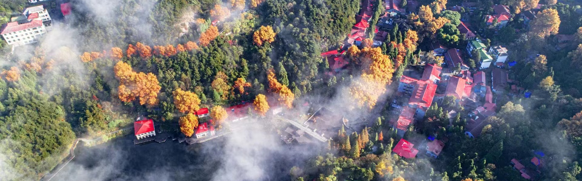
The Mount Lushan Geopark is situated in the north subtropical monsoon warm and heat climate area, at the contact zone between the southwest warm and humid current and north cold air. It stands to the south of the Yangtze River, to the west of Poyang Lake, by the west of Balihu Lake. A large amount of warm and humid current would rise upward along the steep cliffs, when the current meets the cold air on the mountain, they would turn into water, the raining days is 164 days and 190.6 foggy days each year in average. Under this background, the Lushan Mountain area is characterized by many raining, snowing and foggy days. The annual average temperature is 11.5℃ (32℃ ~-16.8℃), and the annual rainfall is 1833.5mm, it is of a maritime climate.
After the glaciations, the rainfall in the Lushan Mountain becomes larger, the vegetation is developed (the forest coverage is 76.6%). There is a frost action in winter. Due to the height difference of landforms, the runoffs are developed, and the flowing water erosion is strong. There are more than 20 perennial rivers. Because the Lushan Mountain is an isolated mountain in a diamond shape, these rivers are radically arranged. There are narrow valleys (90%) and gorges in the middle and upper reaches of these river. The cliffs are on the both sides of the rivers, huge boulders are full of river beds, with the torrent currents roaring forward accompanied by sound music. Due to the developed rivers, rich water resources and many cliffs, the waterfalls are extremely distributed. The famous waterfalls are more than 20. All these waterfalls are graceful, beautiful and even melodious. The most of the waterfalls in Lushan Mountain area are of a three-step structure, that is, for each waterfall, there is a water outlet at the top of a “stone door”, the middle is the waterfall and a deep and green pool at the bottom. For example, the Sandiequan Spring is a three-step waterfall on a glacial stairway cliff, its height difference is 155m, the flow amount is very large, the scenic is extraordinarily beautiful. There is a saying that you would not be a Lushan visitor if you have not visit the Sandiequan Spring. The Huangyan waterfall is located at the stairway below the Huangyan Crique of Xianglufeng Peak, a 45m high cliff was formed after strong flowing water erosion along the shearing joints. There is a famous poem by the great poet, Li Bai of Tang Dynasty for praising this waterfall, that is: The Xianglufeng Peak is rising a purple smoke under the sunshine while you see a waterfall hanging at the front of the peak; the flying water down over thousand meters is just like the milkway falling down from the sky. The Gulianquan Waterfall in the east of Kangwanggu Valley is hanging on a volcanic cliff, the water quality is extremely good, Lu Yi, the Tea Saint of Tang Dynasty named this spring as the“First Spring in the World”. There are a lot of geological heritages just close to these beautiful waterfall, for instance, there are slip folds in sandstones just on the cliff of Wangjiapo Waterfall, the geological heritages add the beauties of nature.
The Poyang Lake is a typical river-connected lake. It is a seasonal freshwater lake, its water area would be up to 5,500km2 in spring and summer. During winter, the lake area is decreased, forming a wetland with an area of over 3,500km2, it becomes a migratory birds, paradise. About 1 million birds would reach here in winter, for instance, more than 98% of the rare white cranes will live here through the winter.